SAM comes with a set of representative typical wind resource files that are appropriate for very preliminary studies to explore the feasibility of potential projects, or for policy studies. The files were developed in 2012 for NREL by AWS Truepower. Each file contains simulated hourly resource data and includes wind speed, wind direction, ambient temperature, and atmospheric pressure data at 50, 80, and 110 meters above the ground.
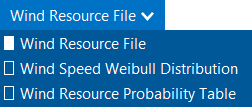
Choose a representative typical wind resource file:
1.In the list of files, choose the name of the file. You can type a few letters of a location name to filter the list.
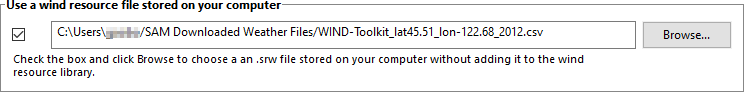
The file may be one of the typical wind data files included with SAM, a wind data file you downloaded, or a file that you created with your own data.
Note. To view the wind resource data in SAM's time series data viewer, run a simulation, and click the Time Series tab on Results page.
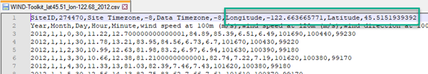
SAM displays information that describes the location represented by the data from the file for your information. This information is stored in the file header. SAM does not use any of this information or data in the simulation.
Description
A text description of where the data in the file came from.
Latitude / Longitude
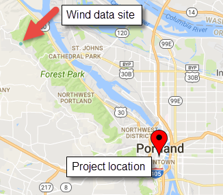
If you use the Download Weather File feature to download a file, this is the latitude and longitude in decimal degrees of the location represented by the data. (It may differ from the latitude of the location you requested.)
If the wind data file does not have a value for the latitude and longitude, SAM displays "N/A."
Elevation above sea level
The location's height above sea level.
SAM does not use this value in calculations. It uses the temperature and atmospheric pressure data from the file to calculate the air density.
City / State / Country
The city, state, and country names stored in the file.
Refresh Library
Refreshes the list of files in the location list. SAM automatically refreshes the list each time you visit the Wind Resource page. If you add a file to one of the folders in the search list, you may need to refresh the list for the file to be visible in the location list.
The files are for 39 representative locations, and use the following naming convention: [State] [Region]-[Terrain Description].srw to help you choose an appropriate file. For example, the file AZ Eastern-Rolling Hills.srw contains data appropriate for a location in eastern Arizona with rolling hills.
•State indicates where the data in the file was measured.
•Region is the part of the state where the data was measured.
•Terrain Description describes the type of terrain at the measurement site. See the table below for Google Earth images of the different terrain types.
Each file contains typical month data for a single year selected from the 14 years between 1997 and 2010. See Typical Year and Single Year Weather Data for a brief description of typical year data.
When you use one of these files, you should examine the data with SAM's Weather Data Viewer to make sure it is appropriate for your analysis. You may want to compare the data in the file to data from nearby meteorological stations or other data. Some things to look for are:
•The annual average wind speed is close to what you expect.
•The prevailing wind direction is similar to what you would expect at the site you are investigating. (This only matters if you are modeling a wind farm with more than one turbine.)
•The annual diurnal wind speed pattern is similar to what you would expect at the site.
Using data with similar terrain type as the site under investigation may help ensure that the wind shear profile (variation of the wind with height above the ground) of the data is reasonable for the site.
If you want to use one of the representative typical wind data files for a location that is not among the 39 representative locations, you can try to find a file with characteristics similar to those of your site.
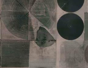
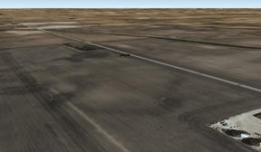
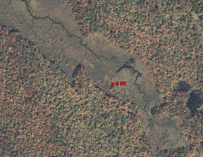
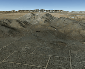
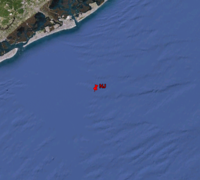
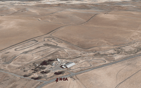
You can use the images below to help choose a typical file with terrain characteristics similar to your site.
Agriculture
|
Barren/Prairie

|
Flat Lands
|
Forest
|
Mountainous
|
Offshore
|
Rolling Hills
|
|
|